null

Thought Leadership


Tag: aerial data acquisition

Applications of GeoReferencing

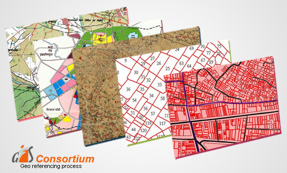
GeoReferencing is the method of assigning the real-world coordinates to each pixel of the raster. Usually, these coordinates are obtained by doing proper field surveys and collecting coordinates with a GPS device for few easily identifiable features in the image or the map.

It is basically a means to associate something with locations in the physical space or the process of associating a physical map or raster image of a map with spatial locations.

The importance of Georeferencing lies in its ability to turn non-spatial imagery into spatial raster data for use in a variety of circumstances. Spatialized air photos can be used for GIS land cover analysis.

Following Are Some of the Uses of Georeferencing:-

• It makes the different imagery required for mapping. It explains how other data, such as the above GPS points, relate to the imagery.

• Necessary information may be contained in data or images produced at a different point in time. It can be used to compare this data with that currently available.

• Different maps may use different projection systems. The tools of Georeferencing contain methods to combine and overlay these maps with minimum distortion.

• Data obtained from surveying may be given a point of reference from topographic maps by the application of GeoReferencing.

• It may be required to establish the significant relationship between social survey results which have been coded with postal codes or street addresses.

Also, for other geographic areas such as census zones or areas such as public administration or service planning.

How To Process LiDAR Data – 3D Survey

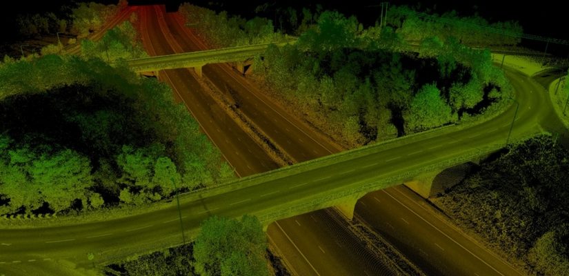
The use of lidar data processing has erupted in recent years, for many good reasons. The Lidar technology helped in producing higher-quality results than traditional photogrammetric techniques that cost low. Therefore, this has created a huge accomplishment to a large extent by the automatically collecting measurements very densely. The progress in laser scanning hardware has been astonishing.

One of the major side effects of switching to lidar-based technology is that it has many challenges in increasing the data volume and the development of software processing abilities required. Fortunately, there are many benefits offered by Lidar technology such as LiDAR Mapping Services, lidar data processing workflow, and Lidar 3D Scans.

Here are Some Tips that enable you to take Advantage of Lidar Data Processing.

1. Have Lidar in LAS Format

Having a lidar in LAS format can be visible to the admitted but not to the one who is new to using lidar data. LAS stand for Laser is the industry standard format for lidar. This helps in choosing the best format that works best.

2. Make Sure the LAS Files Are “Tempered” for Use in GIS

When you have to use LAS, a lot of things go on between initial data collection of LAS files a ready to use the file. Therefore, you can use LAS as there are many flavors out of which some are better than others for use in GIS.

3. Consider Your Options

Look for a company that provides several complimentary options for accessing lidar. Basically, there are three primary data access tools: the LAS dataset, the region dataset, and the mosaic dataset. Therefore, if you will learn about them you will get a better idea to determine which one is for use.

4. Stage Data Appropriately

Lidar data is quite large and requires careful planning to avoid producing a network to its knees or making users wait for long to display.

Therefore, if you have to determine the best overall approach, make sure you get your questions and queries solved. Questions such as – How large is the dataset? And will the whole lidar samples process in order to ad-hoc queries?

Scroll Up