null

Thought Leadership


Tag: Digital Photogrammetric Integration

What Are The Uses of GIS Maps?

GIS technology is widely used by government authorities, large organizations, business companies etc. as it gives detailed information about any location.

It basically captures, analyzes the information and stores the data based on the geographical locations. The resultant presentation is a digital map.

With the advent of computer, GIS mapping technology was invented in 1960. GIS mapping can combine all available data about a given area and deliver it in new and dynamic ways.

There has been a significant growth in the use of GIS maps due to the development of open source applications and it has also become economical for anyone to run GIS.

Geographic Information System

Benefits of GIS Maps :-

• Due to the rapid evolution of consumer electronics enabled with GPS systems, GIS mapping helps tourists to locate their exact location on the geographical map. It can also help them find the nearest gas station.

• Geographic Information System is an essential tool for anyone who wants to create geographical maps with the help of internet. A popular example of such application is Google Maps which is available worldwide.

• The power offered by these tools is perhaps most useful in the world of science. The fields of science gather data about our world in very different ways, but GIS offers unique opportunities to combine all this in one.

• GIS has great importance in the field of education as well.A teacher can use GIS to display digital maps on a projector during their teaching session, so that students can easily understand the syllabus and study in detail about the geographical locations.

Applications of GeoReferencing

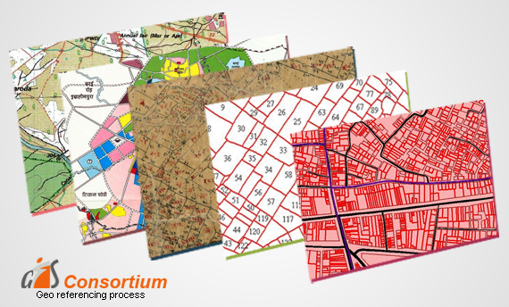
GeoReferencing is the method of assigning the real-world coordinates to each pixel of the raster. Usually, these coordinates are obtained by doing proper field surveys and collecting coordinates with a GPS device for few easily identifiable features in the image or the map.

It is basically a means to associate something with locations in the physical space or the process of associating a physical map or raster image of a map with spatial locations.

The importance of Georeferencing lies in its ability to turn non-spatial imagery into spatial raster data for use in a variety of circumstances. Spatialized air photos can be used for GIS land cover analysis.

Following Are Some of the Uses of Georeferencing:-

• It makes the different imagery required for mapping. It explains how other data, such as the above GPS points, relate to the imagery.

• Necessary information may be contained in data or images produced at a different point in time. It can be used to compare this data with that currently available.

• Different maps may use different projection systems. The tools of Georeferencing contain methods to combine and overlay these maps with minimum distortion.

• Data obtained from surveying may be given a point of reference from topographic maps by the application of GeoReferencing.

• It may be required to establish the significant relationship between social survey results which have been coded with postal codes or street addresses.

Also, for other geographic areas such as census zones or areas such as public administration or service planning.

Scroll Up