null

Thought Leadership


Tag: LiDAR data acquisition

What Are The Uses of GIS Maps?

GIS technology is widely used by government authorities, large organizations, business companies etc. as it gives detailed information about any location.

It basically captures, analyzes the information and stores the data based on the geographical locations. The resultant presentation is a digital map.

With the advent of computer, GIS mapping technology was invented in 1960. GIS mapping can combine all available data about a given area and deliver it in new and dynamic ways.

There has been a significant growth in the use of GIS maps due to the development of open source applications and it has also become economical for anyone to run GIS.

Geographic Information System

Benefits of GIS Maps :-

• Due to the rapid evolution of consumer electronics enabled with GPS systems, GIS mapping helps tourists to locate their exact location on the geographical map. It can also help them find the nearest gas station.

• Geographic Information System is an essential tool for anyone who wants to create geographical maps with the help of internet. A popular example of such application is Google Maps which is available worldwide.

• The power offered by these tools is perhaps most useful in the world of science. The fields of science gather data about our world in very different ways, but GIS offers unique opportunities to combine all this in one.

• GIS has great importance in the field of education as well.A teacher can use GIS to display digital maps on a projector during their teaching session, so that students can easily understand the syllabus and study in detail about the geographical locations.

Applications of GeoReferencing

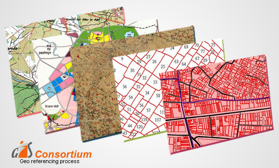
GeoReferencing is the method of assigning the real-world coordinates to each pixel of the raster. Usually, these coordinates are obtained by doing proper field surveys and collecting coordinates with a GPS device for few easily identifiable features in the image or the map.

It is basically a means to associate something with locations in the physical space or the process of associating a physical map or raster image of a map with spatial locations.

The importance of Georeferencing lies in its ability to turn non-spatial imagery into spatial raster data for use in a variety of circumstances. Spatialized air photos can be used for GIS land cover analysis.

Following Are Some of the Uses of Georeferencing:-

• It makes the different imagery required for mapping. It explains how other data, such as the above GPS points, relate to the imagery.

• Necessary information may be contained in data or images produced at a different point in time. It can be used to compare this data with that currently available.

• Different maps may use different projection systems. The tools of Georeferencing contain methods to combine and overlay these maps with minimum distortion.

• Data obtained from surveying may be given a point of reference from topographic maps by the application of GeoReferencing.

• It may be required to establish the significant relationship between social survey results which have been coded with postal codes or street addresses.

Also, for other geographic areas such as census zones or areas such as public administration or service planning.

Advantages of GIS Services across Different Sectors

GIS Services is a technology specifically designed to capture, analyze, manage and present all types of spatial and geographical data.These services have aided national security and law enforcement as well. Several companies are reaping big benefits due to these GIS services. They rely on the data rooted in computer mapping and satellite imageries to leverage work efficiency, take strategic decisions and select a better consumer group and increase the efficiency of the business.

These services basically aids essential business functions such as marketing, logistics and strategic decision making. The company offering such services provides valuable support in defining business requirements.Also, industry policies and standards, database design and implementation, application development.

Services Providing Area

For Business

The GIS services uses technology to trace location.This is very useful in marketing and sales, logistics and transportation, human resource and other fields. It is well integrated with targeted marketing and market analysis, routing and logistics.

For Education

GIS is now a very important tool that helps the education department to send across the answers from local to global implications.

Natural Resources

This technology helps biologists, ecologists, environmental regulators, astronomers, and miners etc to make difficult decisions regarding the handling of the earth’s natural resources.

Government

Due to the improved decision making processes, as a result of GIS, service delivery and citizen management have become easier. As most of the data in the government is location-based.Thus, smoother operations can be expected.

Maritime

GIS technology also provides good assistance in mapping and charting in Aeronautic and Maritime fields. It immediately starts producing geospatial data and provides high quality products with tools in making and maintaining the results.It also tracks the status and progress of jobs through the complete cycle.

How To Process LiDAR Data – 3D Survey

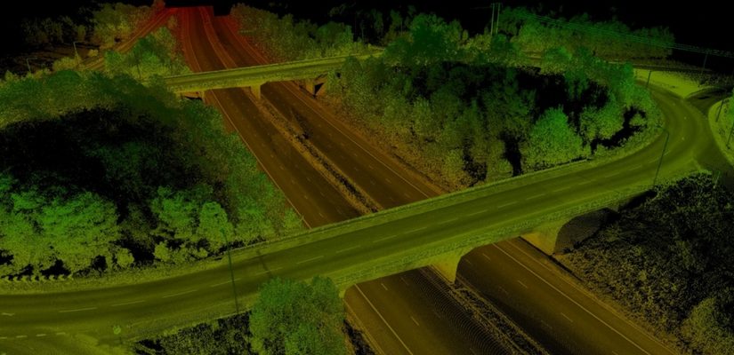
The use of lidar data processing has erupted in recent years, for many good reasons. The Lidar technology helped in producing higher-quality results than traditional photogrammetric techniques that cost low. Therefore, this has created a huge accomplishment to a large extent by the automatically collecting measurements very densely. The progress in laser scanning hardware has been astonishing.

One of the major side effects of switching to lidar-based technology is that it has many challenges in increasing the data volume and the development of software processing abilities required. Fortunately, there are many benefits offered by Lidar technology such as LiDAR Mapping Services, lidar data processing workflow, and Lidar 3D Scans.

Here are Some Tips that enable you to take Advantage of Lidar Data Processing.

1. Have Lidar in LAS Format

Having a lidar in LAS format can be visible to the admitted but not to the one who is new to using lidar data. LAS stand for Laser is the industry standard format for lidar. This helps in choosing the best format that works best.

2. Make Sure the LAS Files Are “Tempered” for Use in GIS

When you have to use LAS, a lot of things go on between initial data collection of LAS files a ready to use the file. Therefore, you can use LAS as there are many flavors out of which some are better than others for use in GIS.

3. Consider Your Options

Look for a company that provides several complimentary options for accessing lidar. Basically, there are three primary data access tools: the LAS dataset, the region dataset, and the mosaic dataset. Therefore, if you will learn about them you will get a better idea to determine which one is for use.

4. Stage Data Appropriately

Lidar data is quite large and requires careful planning to avoid producing a network to its knees or making users wait for long to display.

Therefore, if you have to determine the best overall approach, make sure you get your questions and queries solved. Questions such as – How large is the dataset? And will the whole lidar samples process in order to ad-hoc queries?

How does GIS Prove Useful for the Government?

The Digital India Initiative is at full flow and with it many projects have come up. India is on a path of digital transformation and Geographic Information Systems have found great use in this initiative. GIS technology has allowed for better collection and analysis of data and ensured that local and even national Governments can now make more informed decisions about a particular geographic area.

GIS Service for Government Sector

GIS has evolved through the years and become much smarter than what it initially was. With latest technologies and equipment GIS services are able to provide a more in depth look into an area and help in better decision making. From natural resource management, to businesses, transportation, emergency response, urban planning and even health care such technology has found application in so many areas. It has proved to be a beneficial system for Government needs all over the world. Some of the many ways in which GIS proves useful for Governments include-

• It can help in better disaster management- Advanced planning can help avert major catastrophes and save numerous lives. GIS can be used to assess areas that are susceptible to disaster and thus, allow for better management

In health care also such systems find use and can help a lot in containing an epidemic. It can help the medical industry understand areas better and know which place needs what type of health care

The vision of smart cities can also benefit a lot from such systems

Emergency management and utility management can also be better handled with the use of such systems

With such urgency to protect our natural resources here too such systems can help in a big way

There are a lot more applications of GIS technology in Government needs and it is important that they make use of it to plan and make the best possible decisions.

Scroll Up