null

Thought Leadership


Tag: Photogrammetry

What Are The Uses of GIS Maps?

GIS technology is widely used by government authorities, large organizations, business companies etc. as it gives detailed information about any location.

It basically captures, analyzes the information and stores the data based on the geographical locations. The resultant presentation is a digital map.

With the advent of computer, GIS mapping technology was invented in 1960. GIS mapping can combine all available data about a given area and deliver it in new and dynamic ways.

There has been a significant growth in the use of GIS maps due to the development of open source applications and it has also become economical for anyone to run GIS.

Geographic Information System

Benefits of GIS Maps :-

• Due to the rapid evolution of consumer electronics enabled with GPS systems, GIS mapping helps tourists to locate their exact location on the geographical map. It can also help them find the nearest gas station.

• Geographic Information System is an essential tool for anyone who wants to create geographical maps with the help of internet. A popular example of such application is Google Maps which is available worldwide.

• The power offered by these tools is perhaps most useful in the world of science. The fields of science gather data about our world in very different ways, but GIS offers unique opportunities to combine all this in one.

• GIS has great importance in the field of education as well.A teacher can use GIS to display digital maps on a projector during their teaching session, so that students can easily understand the syllabus and study in detail about the geographical locations.

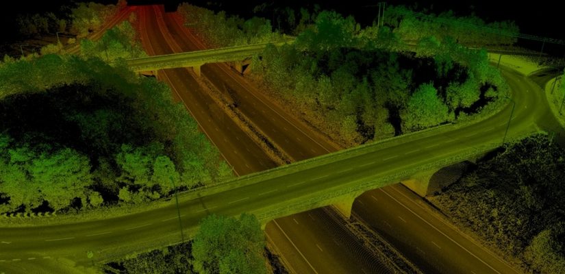
How To Process LiDAR Data – 3D Survey

The use of lidar data processing has erupted in recent years, for many good reasons. The Lidar technology helped in producing higher-quality results than traditional photogrammetric techniques that cost low. Therefore, this has created a huge accomplishment to a large extent by the automatically collecting measurements very densely. The progress in laser scanning hardware has been astonishing.

One of the major side effects of switching to lidar-based technology is that it has many challenges in increasing the data volume and the development of software processing abilities required. Fortunately, there are many benefits offered by Lidar technology such as LiDAR Mapping Services, lidar data processing workflow, and Lidar 3D Scans.

Here are Some Tips that enable you to take Advantage of Lidar Data Processing.

1. Have Lidar in LAS Format

Having a lidar in LAS format can be visible to the admitted but not to the one who is new to using lidar data. LAS stand for Laser is the industry standard format for lidar. This helps in choosing the best format that works best.

2. Make Sure the LAS Files Are “Tempered” for Use in GIS

When you have to use LAS, a lot of things go on between initial data collection of LAS files a ready to use the file. Therefore, you can use LAS as there are many flavors out of which some are better than others for use in GIS.

3. Consider Your Options

Look for a company that provides several complimentary options for accessing lidar. Basically, there are three primary data access tools: the LAS dataset, the region dataset, and the mosaic dataset. Therefore, if you will learn about them you will get a better idea to determine which one is for use.

4. Stage Data Appropriately

Lidar data is quite large and requires careful planning to avoid producing a network to its knees or making users wait for long to display.

Therefore, if you have to determine the best overall approach, make sure you get your questions and queries solved. Questions such as – How large is the dataset? And will the whole lidar samples process in order to ad-hoc queries?

Scroll Up