Data Conversion
Thinking of data conversion? Think GIS Consortium.

Thinking of data conversion? Think GIS Consortium.
Geospatial data is captured from different platforms and in various formats. It therefore requires constant data conversions from one format to others. Cost-efficient & effective GIS data conversion services are always in demand to convert different GIS datasets from one format to another to avoid their recreation.
GIS data conversion services generally encodes geographical format in each file. With increasing use of geographical content into different sectors like telecom, electric utilities, retail, oil & gas, real estate, banking, insurance, GIS data conversion outsourcing is the best choice of converting the hard copy into digital formats and maximise the benefits of available data.
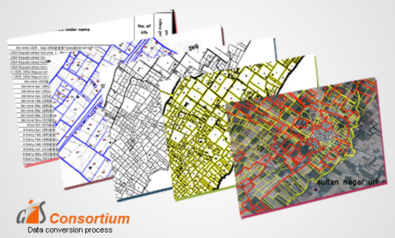
With a team of highly qualified data engineers, we offer data conversion outsourcing where raster images are transformed to vector formats and vice versa without losing the data quality and veracity. The data conversion services offered by us takes care of the compatibility and interoperability between formats which generally creates big issues while moving data between various applications.
Outsource your GIS data conversion into our reliable hands and we will ensure seamless data conversion across various formats that are compatible to any software application and solution.

Data conversion projects outsourcing is more than just a service, it is building partnerships and forming long lasting relationships. Further, with technological advancements and coming together of diverse technologies both in spatial as well as non-spatial data, data conversion outsourcing services now involves integration and interoperability among the varied data formats and types.
Data conversion outsourcing services now have to re-engineer the data from one format to another. This requires highly skilled manpower in data science and engineering. Having a consistent experience of timely delivery of projects to both national and international clients for more than 18 years we are one of the reliable data conversion outsourcing companies.


One of the most valuable aspects in GIS is the digital representation of an image. GISC has the capability to convert hard copy into a wide range of electronic formats. Our integrated processes for conversion convert architectural, mechanical and various technical drawings, maps and other types of line artwork into the desired formats with fine quality of high-end products.
In some cases, the data is already in a digital format, but often this data is not compatible with the current or other system. Conversion of data from one digital format to a new digital format is referred to as data translation. GISC’s team of experienced and multi-skilled specialists has a vast knowledge of converting various types of geospatial data.