Photogrammetry Through Lidar

Photogrammetry

Unlocking the potential of photographs

Digital Photogrammetric Mapping & Integration

Mapping through Photogrammetry

We are a leader in digital photogrammetric mapping, change detection and GIS database updating, satisfying client specifications and supporting data integration.

GISC offers photogrammetric services from Aerial Photographs and Stereo Satellite Images using the latest aerial and satellite photography equipment, software and state-of-the-art technology.

GISC provides photogrammetric solutions to meet the user’s needs with the best quality and at a globally competitive price. The solutions are tailor-made based on the specific requirements of the clients.

Services offered include:

• Aerial Photography, LiDAR Data Acquisition & High Resolution Satellite Images
Procurement
• Digital Aerial Triangulation for Aerial Photos/Exterior Orientation(EO) for Satellite
Imagery
• Topographic/Planimetric Mapping and Updating
• DEM/DTM/ Contour Generation
• Digital Ortho-photo Generation/ Mosaicing/ Tiling

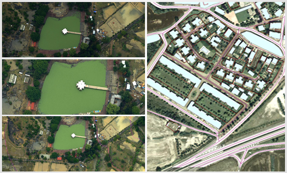
GISC’s ortho-photography data processing workflow system is completely integrated with its photogrammetric mapping and GIS processes. GISC’s specialised team uses some of the most advanced software to accurately create and produce high accuracy products from high resolution imageries.

Contour MappingContour is an imaginary line of equal height values which shows the generic shape of the terrain. It is useful for many engineering projects, layout planning maps and slope analysis.
DEM /DTMCreating the data in 3 dimensions has given new perspectives to GIS. Three-dimensional viewing can provide such in depth details that would not be apparent from a 2D map. 3D is not only for viewing purposes but can be useful for many professional analysis and applications like watershed management, land slide hazard zonation, urban planning and management.
OrthorectificationOrthorectification is a process of removing the geometrical error from satellite imagery or aerial photography. It plays a vital role in accurate mapping in terms of distance, dimensions and area, etc. GIS Consortium has an expertise of generation of orthophoto, height model with a use of complete range of photogrammetry.

Other Services

Scroll Up