null

Thought Leadership


Tag: photogrammetric services

Applications of GeoReferencing

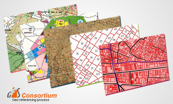
GeoReferencing is the method of assigning the real-world coordinates to each pixel of the raster. Usually, these coordinates are obtained by doing proper field surveys and collecting coordinates with a GPS device for few easily identifiable features in the image or the map.

It is basically a means to associate something with locations in the physical space or the process of associating a physical map or raster image of a map with spatial locations.

The importance of Georeferencing lies in its ability to turn non-spatial imagery into spatial raster data for use in a variety of circumstances. Spatialized air photos can be used for GIS land cover analysis.

Following Are Some of the Uses of Georeferencing:-

• It makes the different imagery required for mapping. It explains how other data, such as the above GPS points, relate to the imagery.

• Necessary information may be contained in data or images produced at a different point in time. It can be used to compare this data with that currently available.

• Different maps may use different projection systems. The tools of Georeferencing contain methods to combine and overlay these maps with minimum distortion.

• Data obtained from surveying may be given a point of reference from topographic maps by the application of GeoReferencing.

• It may be required to establish the significant relationship between social survey results which have been coded with postal codes or street addresses.

Also, for other geographic areas such as census zones or areas such as public administration or service planning.

How does GIS Prove Useful for the Government?

The Digital India Initiative is at full flow and with it many projects have come up. India is on a path of digital transformation and Geographic Information Systems have found great use in this initiative. GIS technology has allowed for better collection and analysis of data and ensured that local and even national Governments can now make more informed decisions about a particular geographic area.

GIS Service for Government Sector

GIS has evolved through the years and become much smarter than what it initially was. With latest technologies and equipment GIS services are able to provide a more in depth look into an area and help in better decision making. From natural resource management, to businesses, transportation, emergency response, urban planning and even health care such technology has found application in so many areas. It has proved to be a beneficial system for Government needs all over the world. Some of the many ways in which GIS proves useful for Governments include-

• It can help in better disaster management- Advanced planning can help avert major catastrophes and save numerous lives. GIS can be used to assess areas that are susceptible to disaster and thus, allow for better management

In health care also such systems find use and can help a lot in containing an epidemic. It can help the medical industry understand areas better and know which place needs what type of health care

The vision of smart cities can also benefit a lot from such systems

Emergency management and utility management can also be better handled with the use of such systems

With such urgency to protect our natural resources here too such systems can help in a big way

There are a lot more applications of GIS technology in Government needs and it is important that they make use of it to plan and make the best possible decisions.

Scroll Up