null

Thought Leadership


Tag: GIS services

Learn How GIS Is Revolutionizing the Smart City Projects

The smart city concept is developing quickly around the world because it provides comprehensive geospatial data in a user-friendly environment. This article shows how GIS could help in the implementation of smart city projects and describes its usage on large scale projects. The ‘Smart City’ concept aims at developing a comprehensive system that effectively uses geospatial data to develop a better understanding of complex urban systems and boost the efficiency of these systems.

The emergent technology enables cities to achieve more agile management that can enhance the quality of life to citizens and economic development and also reinforces the involvement of citizens in the city. Though it was quite difficult to implement it earlier with the help of GIS consultant India, it has become much smoother and simpler. It allows the collection of data concerning how the city infrastructure and stakeholders should be developed for safe living.

Use of GIS in Smart City Projects

The implementation of a smart city is based on a number of steps which includes the construction of an urban digital model, data collection, data analysis, data visualization, and system control. Some crucial GIS steps are given below:

Construction of the Urban Digital Model

This is the first step in the implementation of GIS in smart city projects. A digital model is created which provides geolocalisation and characteristics. It usually consists of horizontal components like urban networks, natural environment, transport facilities, etc., while building information modeling (BIM). The combination of GIS and BIM provides a powerful combination for the construction or urban digital model in a user-friendly way.

Sensing Layer

The second step in smart city projects contains the construction of the sensing layer that transfers urban operating data to a smart city information system. This layer includes sensors used for monitoring urban infrastructure and network which is often enhanced through various technologies. The sensors used in water, drainage and electrical system allow early detection of faults and signal calamity like floods.

Data Analysis

This is the third step that involves the development of the analytic environment, which converts real-time data into operational data that indeed boost the efficiency, security, and quality of urban planning. It includes management, engineering, and safety software for urban systems and also includes advanced digital tools like Artificial Intelligence.

Interactive Data Visualization

Interactive data visualization allows users to interact with the stakeholders and the smart city’s components in a user-friendly environment. Various web applications are used for this purpose like HTML popups, interactive GIS graphics, sensor maps, etc.

Control Layer

Data analysis of real-time and historical data results in commands for the safe and efficient management of urban systems. These commands are transmitted to the control layer, which includes different electronic devices like pumps, smart valves, switches, motors, locks, and breakers. The GIS system also enables real-time monitoring of these devices.

Conclusion

This article has presented the implementation of GIS in smart city projects but if you want to make it even easier then you should contact a reputed GIS company India like us. We provide powerful tools and services for the successful completion of such projects.

What is GIS data? What are it’s Benefit?

Data is an essential component of Geographic Information Systems. With the most up-to-date, accurate GIS data available, you can develop strategies, automate workflow, target customers, and optimize processes.

GIS data in business provides the ability to perform a thorough review of business information, from analysis to action.

Here Mentioned are Some of the Crucial Benefits:-

From 2D to 3D

In order to understand a two-dimensional representation of the real landscape, you need a level of interpretation and imagination. The physical world exists in three dimensions and. Unless you ignore those extruded plastic maps of the world, the realm of conventional maps is determinedly flat. The ability of Geographic Information Service to produce dynamic and attractive three-dimensional maps is one of its most exciting benefits.

Link-Node Topology

A GIS does more than just show the positions of objects on a computer screen. It can also be used to model real-world events and networks. There are many networks in geographical data. It can analyze the potential flow around these networks. It can only do this if the data has the right network topology.

Polygon Topology

The area features are defined in a Geographic Information Services by the linear shape of the perimeter and some kind of reference point indicating that the space enclosed by those lines relates to a geographical feature.

The Geospatial GIS data is often captured in the form of linework showing the extent of physical features on the ground, like fences, roads, and rivers. The area features then have to be identified by assigning points to each bit of space in the resulting map data. It is very essential to avoid undershoots in the data, otherwise, the system cannot tell whether an area is closed at a particular point.

3D GIS Data

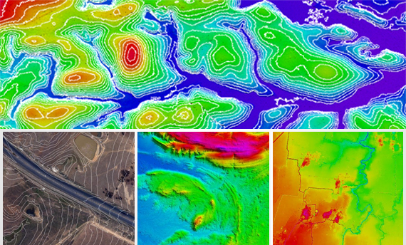
The information of height can be captured in a GIS in exactly the same way as the shape and location of objects. The remarkable ability of today’s computers to perform calculations means that 3-D models of the ground surface can be constructed from data recording the height at distinct points across an area.

Most 3D Geographic Information Services data is stored as a grid of points, with x, y and z values stored as attributes, often referred to as a digital terrain model (DTM) or digital elevation model (DEM).

Conclusion:-

The core of any GIS technology solution is geo-database. For availing good quality Geographic Information Services, you must certainly get in touch with the reputed GIS Solution Company. These companies have extensive experience in converting the existing data to spatial data that meets the defined business goals, using appropriate data conversion, migration and QA tools.

What is The Use of Application of GIS Services in Smart Cities?

What is Smart City?

Smart city is the city of tomorrow. It tries to identify a smarter option from legacy system for maximizing the end-user satisfaction and accelerating urban socio-cultural and economic development. It is a knowledge based city functioning on most latest and updated information on automated decision making and rapid action for individuals.

GIS and Smart City

Today, a growing number of cities rely on Geographical Information Systems to unlock powerful insights that would otherwise be hidden in data. GIS Services has got the proficiency to model the real world of the city in totality. It can incorporate a huge amount of variables and has the capacity to geocode variables. It is deployed at every stage of planning and development of a Smart City.

What Are The Benefits of Application of GIS in Smart Cities?

• It can help create smart communities to analyze and find issues for local community.
• It can identify appropriate representatives for multi-level local governance as part of self-organizing policy.
• It can improve utilization of existing infrastructure capacity, improving quality of life.
• Can provide real-time guidance on how best to exploit multiple transportation modalities and make new services available.
• It can help visualizing spatial impacts of situations and migratory patterns. Also, assist in planning for urbanization.
• It allows smart city managers to utilise a user-friendly and widely used digital system in the management of urban systems.


Use of Geographic Information Services In Smart City Projects

The implementation of smart city projects is based on a number of steps such as:-

Creation of the Urban Digital Model

The first step in the application of smart city projects concerns the construction of the urban digital model. It describes the components of the urban built and natural environments. GIS is normally used for the construction of the digital model of urban horizontal components.

Sensors Utilized In Water and Energy Utilities Monitoring

The second step in smart city projects concerns the creation of the sensing layer. It transfers urban operating data to the smart city information system. This layer comprises sensors used for monitoring urban networks and infrastructures.

Analysis of Data

The third step in executing a smart city project concerns the development of the analytic environment. This converts real-time and historical data into operational data that improves the security, efficiency and quality of urban systems.

Interactive Visualization of Data

The interactive Geographic Information Services graphic environment allows the visualisation of urban components and sensors maps. Users can utilise these maps to access static and dynamic data concerning urban systems as well as to update the data.

The Control Layer

Data analysis of historical and real-time data results in commands for the optimum and safe management of urban systems. This technology allows real-time visualisation of these devices as well as their status. It could also visualise errors in device command.

For high quality GIS Solutions, you may get in touch with experienced GIS Services Company, India.

How Can GIS Help To Tackle Climate Change?

The Greenhouse gas emissions resulting from human activities in the industrialized world have led to a steady increase in the average global temperatures. Melting glaciers, increase in the numbers of storms, soil erosion and other natural calamities are the outcome of climate change.Climate change has far-reaching effects on Earth’s ecosystems. It includes forest cover, water bodies, human activities, and wildlife. Each and every life form has a different level of sensitivity to these changes. The level to which the ecosystem will be affected by a climatic change is termed as vulnerability.

The analytical capabilities of GIS enable a researcher to store large amounts of information about a specific ecosystem and study it’s vulnerability. Besides, the data obtained by it can help the scientists rank areas based on it. Thus, allowing the scientists to prioritize their efforts in dealing with vulnerable hot spots.

But, the adoption of Geographic Information Services technology has also gathered criticism. The technology makes it possible to collect minute details from an identified geography. Therefore, the privacy concerns and the potential for misuse of such data exist. Some government agencies have implemented the privacy protocols to maintain the flow of information.

Geographic Information System

Scientists use GIS mapping technology that uses methods of statistical analysis, database functions, and visualization benefits to study the impact of climatic changes. Depending on the basis of these insights, researchers create profiles that prove the vulnerability of a specific geographical area to changes in it’s climate.

What Are The Different Uses of GIS in Climate Change Detection?

• This technology is helpful for environment understanding, in strategic decision making and climate change monitoring. It is also vital in predictions of disaster risks in forest and agriculture sectors.
GIS Service professionals put their varied expertise, knowledge and experience for the climate change monitoring, carbon management, disaster management.
• This valuable technology is significant for identification of current and future risks and susceptibilities of climate change. Therefore, it is helpful for the design and implementation of adaptation operations.

For Understanding global scale earth system and for taking strategic decisions, GIS base framework is very useful.

Skillful expertise is required for the climate change detection through the use of this technology. Many environmental analysts using this technology for understanding such climatic complex issues and offering some important solutions.

Conclusion:-

For appropriate and effective Geographic Information Services in order to deal with the climate related issues, you may seek assistance with our team of qualified and experienced professionals.

About Application of GIS Services in Urban Planning

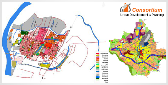
GIS technology is used to analyze the urban growth and its direction of expansion, and to find suitable sites for further urban development.

In order to recognize the sites suitable for the urban growth, certain factors have to consider which is:-

• Land should have proper accessibility

• It should be more or less flat

• It should be vacant or have low usage value currently and it should have good supply of water.

Geographic Information System has been used in several industries and across a variety of professions.

Here is a look at some of it’s applications in the field of urban planning and the role it plays in this field.

The Resource Inventory

Geographical information, when combined with remote sensing, can save time in collecting land use and environmental information. Remote sensing images are becoming an imperative source of spatial information for urban areas. They can help to find out land use and land use changes for whole urban areas. The stereoscopic pairs of digital aerial photographs can be used to derive 3-dimensional CAD models of buildings for dynamic visualization of a city, or for direct import into a GIS database.

Scrutinizing the Existing Situations

Geographic Information System can help to collect, manipulate, and examine physical, social, and economic data of a city. Planners can then utilize the spatial query and mapping functions to analyze the existing situation in the city.

Through the map overlay analysis, GIS companies can help to detect areas of conflict of land development with the environment by overlaying existing land development on land suitability maps.

The areas of environmental sensitivity can be identified using remote sensing and other environmental information. This data and analysis can then be used to inform significant decisions that affect the current and future planning of an area.

Modelling and Projection

A basic function of planning is the projection of future population and economic growth. Geographic Information System can be used for prediction and projection. Spatial modeling of spatial distributions makes it possible to evaluate the widest range of impacts of existing trends of population, economic and environmental change.

Environmental planning models have been developed to identify areas of environmental concern and development conflict, using socioeconomic and environmental data stored in GIS.

Regarding Latest GIS Approach to Optimize Service Area Boundaries for ACOs

The population of patient is typically defined by who has already been seen for care. These systems often use the patient registries in their EMRs to define the population of patient. Also, base their analysis on current diagnoses or self-identified demographics.

However, there is a better way of using GIS location technology and supporting data sources that may be especially useful for ACOs and other organizations concerned with managing population health.

Utilizing GIS Services for Location Technology in Healthcare

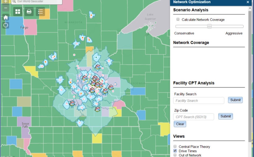
A more accurate approach would be to first objectively define the geography within which the health system operates. Secondly, to define the subsequent population belonging to that overall service area. This is known as network coverage optimization. It offers a more robust way to define boundaries and identify populations.

As the geography-based care population is well defined, value-based strategies, such as disease cohort underwriting or at-risk contracting, become more realistic. Within a speedily changing healthcare market, it makes sense to leverage location analytics for more robust strategic assessments for healthcare systems.

A healthcare organization of all kinds should use GIS location technology to clearly define patient populations and determine sound strategies and decisions.

Determining Adequate Service Coverage

One simple approach to measure adequate service coverage across population density is to envision access times for various healthcare facilities.

To better measure the overall viability of this health system, a network coverage score can be calculated using zip code and population-based statistics. This score represents a system’s enrolled patients as compared to the total population. This type of scoring could also be used to compare health systems in various locations.

Optimized Service Area Boundaries result in an improved understanding for Population Health Management Strategy.

How Does ACOs Benefit from GIS Technology?

• ACOs derive a better understanding of their enrolled patients and eligible payer groups, using GIS-powered analytics to define their patient populations.
• A strategic population analysis coupled with the novel visualizations can yield better decisions in population health management, leading to enhancing quality and lowered cost, both imperative for ACOs to thrive.
• GIS location technology can be used to easily identify objective service area boundaries relevant to a specific healthcare system. This automated method of defining the service area also identifies the exact population for which health coverage is currently provided. The Population characteristics from several external source data are also leveraged.

Wireless Sensor Networks (WSN) and Applications

Wireless sensor networks are a group of specialized devices or sensors used to monitor different environmental conditions. Also, to collect and organize that data at some central location.

It measures a number of physical conditions. Also, chemical concentrations, vibrations, pollutant levels and many other such conditions. It has many application with microcontroller projects.

There are a various nodes in a sensor network. These nodes are the detection stations. In every sensor node, there is a sensor/transducer, microcontroller, transceiver and power source.

Types of Wireless Sensor Networks:

Terrestrial WSNs – These types of networks consist of huge number of wireless sensor nodes. These nodes can be organized in an unstructured or a structured manner. The nodes are distributed unsystematically. But they are kept within the target area.

They are over ground and solar cells can be used to power up these networks. Energy can be conserved by reducing delays and using operations of low duty cycles etc.

Underground WSNs – These sensor networks are more expensive as compared to terrestrial networks. These are used to monitor the underground conditions. Therefore, their whole network is underground.

Underwater WSNs – This network system comprises of sensor nodes and vehicles which are deployed under the water. Underwater vehicles are to be used to gather data from the sensor nodes.

Multimedia WSNs – These sensor networks can gather information in the form of audio or video etc. The sensor nodes are connected with cameras and microphones. They can track and monitor different events. Also, can keep a visual display of the events also.

Mobile WSNs – The mobile network is not fixed rather the sensor nodes can move from one place to any other. Their main advantage is that they provide better coverage, more channel capacity and enhanced coverage.

Applications of Wireless Sensor Networks:

There are numerous applications of WSNs in industrial automation, traffic monitoring and control, medical device monitoring and in many other areas, such as:-

Disaster Relief Operation – If an area is reported to have been hit by some sort of calamity such as fire then the sensor nodes can be dropped on the fire from an aircraft. The data of each node can be monitored. A temperature map can be used to devise proper ways and techniques to overcome the fire.

Military Applications – They are very useful in military operations for sensing and monitoring friendly or hostile motions. The surveillance of battlefield can be done through the sensor nodes to keep a check on everything. The nuclear, biological or chemical attacks can also be detected through the sensor nodes.

Environmental Applications – These sensor networks have a huge number of applications in the environment used to track movement of animals, birds and record them. Monitoring of earth, soil, irrigation and precision agriculture can be done through these sensors. Also, can also used for the detection of fire, flood, earthquakes etc.

Medical Applications – It can help in keeping a check on drug administration in hospitals and in monitoring patients as well as doctors.

For good quality GIS Services such as Geo Wireless Network Establishment or Wireless Network Mapping etc. you may reach us.

Role of Lidar in Preventing and Mitigating Landslides

LiDAR is a commonly used application in high precision sensors in autonomous cars, photogrammetry and bathymetry but it is certainly not limited to it. Do you know that it can also be used in detecting and analyzing the natural disasters like landslides? Landslides lead to huge loss of life as well as property but what if it could be detected and prevented on time.

Lidar- A Tool for Geologists

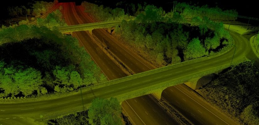
Geologists now use LiDAR as an effective medium to predict and thoroughly study landslides. Government and scientists have integrated the airborne LiDAR as a major component in disaster mitigation initiatives. Data which is gathered using LiDAR efficiently provides useful insights into geographical risk zones which contributes in the identification of vulnerable areas. One of the main advantage of using this technology is that it provides the images even under thickly vegetated areas along with other hidden details like extent of deformation, slope angle etc. All the above information validates that LiDAR is a valuable tool in landslide assessment.

Cutting Edge Analysis and Preemptive Data

LiDAR helps in getting even minute details and offers an inclusive view, the data is either collected by analyzing the terrain surface or by detecting change between the surfaces on a regular period of time. In prior, the surface features and associated properties are thoroughly analyzed to identify parameter values whereas the later focusses on detecting changes in surface movement and deformation. In both the methods, surface representation is assessed.

Disaster Mitigation

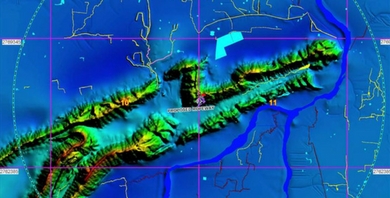
Combining LiDAR with GIS services improves the accuracy and quality of geological data. It enables geologists and disaster management experts to identify landslide prone areas. After marking a site, they start studying the underlying causes of landslide. LiDAR Data Processing reveals subtle surface details that can’t be captured by aerial photographs. The Geo Spatial Data has increased the efficiency of landslide observation a multiple time, which has raised the chances to mitigate landslide.

What is the Importance of GIS Data Conversion?


Esri, the global leader in spatial analytics informed about the release of Intelligence Configuration for ArcGIS Pro (ICAP). This will bring the most commonly used ArcGIS data management tools to the forefront in order to better support intelligence analysts.

Document, E-book and pdf conversion among others are the different kinds of data conversion.

GIS Data Conversion

• It is a critical process in the migration of information from existing information databases to new ones that often require changes in data formats.
• It refers to the alteration and transfer of data between different systems, when the systems undergo replacement or updates.
• It is also of great importance in the insurance sector. Companies can make use of different strategies for converting data to ensure that the data is compatible with their systems.

Right data conversion should ensure the following:-

• Data is converted into an appropriate format and is transferred correctly
• Data works in the new destination database
• Data retains it’s quality and data consistency is maintained at all times across all the systems.

GIS Consortium has the capability to convert hard copy into a wide range of electronic formats. GISC’s team of experienced and multi – skilled specialists have a vast knowledge of converting various types of geospatial data. It can deal with the present day challenges such as complexity of data, project timelines and effect on the quality and accessibility of the data, ensuring a smooth and successful data conversion.

For a good quality GIS Services, you can get in touch with the GIS Consortium.

A Brief Description About GIS Services

The objective of GIS is to identify new trends from the analyzed research. It is a system used to gather data and incorporate it in order to store, scrutinize, distribute and show geographic information.

Studying data using the Geographic Information System will help one learn and understand information much quicker and easier.

GIS data displays actual world features such as elevations, terrain and transportation networks in a digital format. It is often used to study global problems in an effort to find solutions much more quickly.

Different GIS Applications –

• An important use of GIS is for studying the climate change. It can be used in the tracking and analyzing of data regarding the impact of climate change.One can map tectonic shifts in high risk earthquake areas, using GIS mapping for public safety.
• In regards to business marketing techniques, a business can use GIS to analyze demographic data to find regions where they will likely sell their products or services.
• Governments can utilize GIS to analyze census information such as health and education statistics. This is helpful for creating or modifying public policies and government spending.
• GIS technology also provides assistance for mapping and charting in Aeronautic and Maritime fields.
• It can be used for security and law enforcement logistics, urban planning and development and evaluating a potential business market.
• Also, in the management of natural resources by National Geo Resource Management, tracking and analyzing natural disasters with the intent of improving emergency response time.There is use of GIS in agriculture as well.

Scroll Up