null

Thought Leadership


Tag: GPS

About Application of GIS Services in Urban Planning

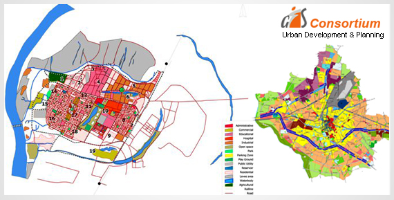
GIS technology is used to analyze the urban growth and its direction of expansion, and to find suitable sites for further urban development.

In order to recognize the sites suitable for the urban growth, certain factors have to consider which is:-

• Land should have proper accessibility

• It should be more or less flat

• It should be vacant or have low usage value currently and it should have good supply of water.

Geographic Information System has been used in several industries and across a variety of professions.

Here is a look at some of it’s applications in the field of urban planning and the role it plays in this field.

The Resource Inventory

Geographical information, when combined with remote sensing, can save time in collecting land use and environmental information. Remote sensing images are becoming an imperative source of spatial information for urban areas. They can help to find out land use and land use changes for whole urban areas. The stereoscopic pairs of digital aerial photographs can be used to derive 3-dimensional CAD models of buildings for dynamic visualization of a city, or for direct import into a GIS database.

Scrutinizing the Existing Situations

Geographic Information System can help to collect, manipulate, and examine physical, social, and economic data of a city. Planners can then utilize the spatial query and mapping functions to analyze the existing situation in the city.

Through the map overlay analysis, GIS companies can help to detect areas of conflict of land development with the environment by overlaying existing land development on land suitability maps.

The areas of environmental sensitivity can be identified using remote sensing and other environmental information. This data and analysis can then be used to inform significant decisions that affect the current and future planning of an area.

Modelling and Projection

A basic function of planning is the projection of future population and economic growth. Geographic Information System can be used for prediction and projection. Spatial modeling of spatial distributions makes it possible to evaluate the widest range of impacts of existing trends of population, economic and environmental change.

Environmental planning models have been developed to identify areas of environmental concern and development conflict, using socioeconomic and environmental data stored in GIS.

Regarding Latest GIS Approach to Optimize Service Area Boundaries for ACOs

The population of patient is typically defined by who has already been seen for care. These systems often use the patient registries in their EMRs to define the population of patient. Also, base their analysis on current diagnoses or self-identified demographics.

However, there is a better way of using GIS location technology and supporting data sources that may be especially useful for ACOs and other organizations concerned with managing population health.

Utilizing GIS Services for Location Technology in Healthcare

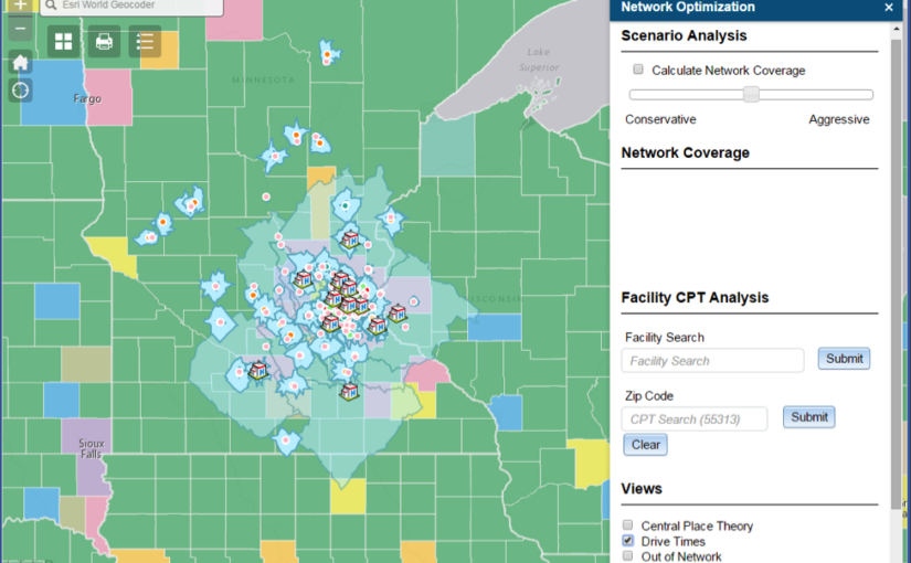
A more accurate approach would be to first objectively define the geography within which the health system operates. Secondly, to define the subsequent population belonging to that overall service area. This is known as network coverage optimization. It offers a more robust way to define boundaries and identify populations.

As the geography-based care population is well defined, value-based strategies, such as disease cohort underwriting or at-risk contracting, become more realistic. Within a speedily changing healthcare market, it makes sense to leverage location analytics for more robust strategic assessments for healthcare systems.

A healthcare organization of all kinds should use GIS location technology to clearly define patient populations and determine sound strategies and decisions.

Determining Adequate Service Coverage

One simple approach to measure adequate service coverage across population density is to envision access times for various healthcare facilities.

To better measure the overall viability of this health system, a network coverage score can be calculated using zip code and population-based statistics. This score represents a system’s enrolled patients as compared to the total population. This type of scoring could also be used to compare health systems in various locations.

Optimized Service Area Boundaries result in an improved understanding for Population Health Management Strategy.

How Does ACOs Benefit from GIS Technology?

• ACOs derive a better understanding of their enrolled patients and eligible payer groups, using GIS-powered analytics to define their patient populations.
• A strategic population analysis coupled with the novel visualizations can yield better decisions in population health management, leading to enhancing quality and lowered cost, both imperative for ACOs to thrive.
• GIS location technology can be used to easily identify objective service area boundaries relevant to a specific healthcare system. This automated method of defining the service area also identifies the exact population for which health coverage is currently provided. The Population characteristics from several external source data are also leveraged.

Scroll Up