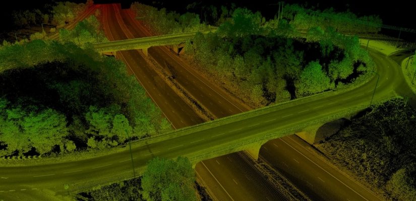
Role of Lidar in Preventing and Mitigating Landslides
LiDAR is a commonly used application in high precision sensors in autonomous cars, photogrammetry and bathymetry but it is certainly not limited to it. Do you know that it can… Read More »

LiDAR is a commonly used application in high precision sensors in autonomous cars, photogrammetry and bathymetry but it is certainly not limited to it. Do you know that it can… Read More »
Today, in the digital world, hard copies need to be converted to digital form before being used for any service. This is because digital maps are easy to maintain. They… Read More »
Esri, the global leader in spatial analytics informed about the release of Intelligence Configuration for ArcGIS Pro (ICAP). This will bring the most commonly used ArcGIS data management tools… Read More »
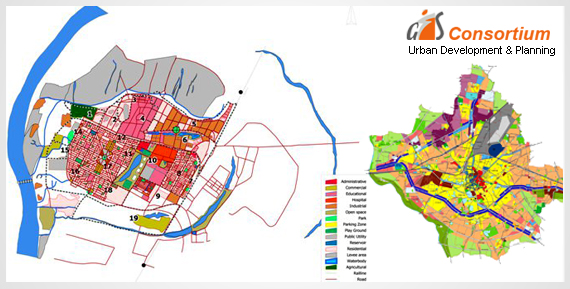
The objective of GIS is to identify new trends from the analyzed research. It is a system used to gather data and incorporate it in order to store, scrutinize, distribute… Read More »
GIS technology is widely used by government authorities, large organizations, business companies etc. as it gives detailed information about any location. It basically captures, analyzes the information and stores the… Read More »