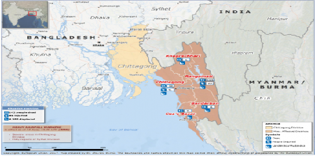
Around 700.000 Rohingya refugees have crossed the border between Myanmar and Bangladesh and live in refugee camps in the landslide exposed areas in eastern part of Bangladesh. With support from the Ministry of The Norwegian Foreign Affairs, NGI did mapping and installed many avalanche warning systems between 2009-12. These systems can predict rainfall induced landslides, and have thereby saved many lives in landslide prone areas. The United Nations Office in Bangladesh is now looking to expand these systems for enhanced landslide management. All of this wouldn’t have been possible without GIS services, which has made such advancements a reality.
Continue reading GIS in Mapping and landslide alert in Bangladesh
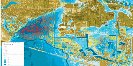
The University of Texas have been working with Esri to support the connection of GIS and water resources. This is specifically in the areas of hydrology and flood mapping. With integrating data such as where people live and work and merging with other modelling domains, like transportation, there is a possibility to connect flood forecasting models with the transportation models. This might improve evacuation planning and first responder deployment. Also, prioritize cleanup and recovery. Thus, it will be a beneficial development in the area of GIS Mapping Services.
Continue reading An Innovative Approach to Flood Mapping
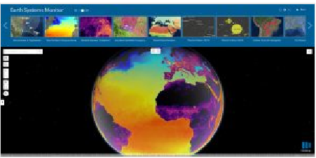
Esri is planning for updation in the ArcGIS Living Atlas of the World. It is a vast collection of geographic information from around the globe. The updates would include new data and capabilities for users to gain insight for helping in decision making. Also, more complete and dynamic picture of the world. The new app by Living Atlas data will allow users to see on a 2D map or a 3D globe historical, forecast and real-time data for depicting land, the oceans and even the human footprint. Due to the adoption of apps, web maps, and collaborative efforts, Living Atlas might support end users who face increasing geospatial data demands,thereby, cater to GIS Services.
Continue reading About Updates by Esri Living Atlas, Related to the Global Change
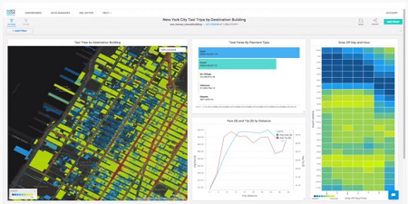
MapD Technologies, the analytics platform provider, has announced the launch of MapD 4.0. The software enables unmatched visual interactivity. This would help for big scale location intelligence use. For example, visually uncovering the relationship between demographic data and spending patterns on a map etc.
MapD 4.0 supports geometry and geographic data types such as points, lines. Also, polygons as well as key spatial operators combined with a newly-enhanced rendering engine.
It has been developed with an aim to give everyone the power to query and visualise data in real-time for incredible new insights that were not possible before. The users can now query and visualise up to millions of polygons with extraordinary speed.
Thus, it is a significant innovation contributing to improved GIS mapping services.
Continue reading Latest Version of MapD for More Interactive Location Intelligence
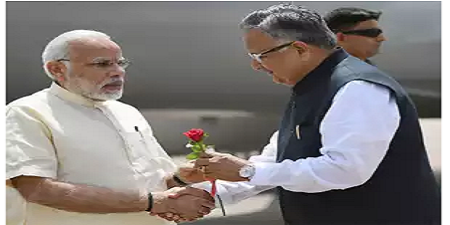
The integrated Command and Control Centre set up at Naya Raipur, which is the upcoming capital city of Chhattisgarh was recently dedicated to the nation by Prime Minister Narendra Modi. The command and control centre will be managed through GIS (geographic information system) Services platform. Due to this facility, residents can register their complaints regarding service dysfunction through the helpline numbers. It seems to be a welcome step towards further development of the nation.
The centre is expected to control and monitor online water and power supply, sanitation. Also, look after traffic movement, integrated building management. It will monitor city connectivity and Internet infrastructure (data centre) as well. All these under a single roof.
Continue reading GIS Services to be Used at Integrated Command and Control Centre set up at Naya Raipur
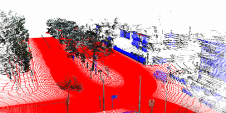
The suitability of Photogrammetry or Lidar point clouds depend on the particular application. Photogrammetric point clouds have an RGB value for each point, resulting in a colourised point cloud. On the other hand, when it comes to accuracy, Lidar is hard to beat. Since all the projects do not require the same accuracy, it is always good to do some research before you decide which method works best for you.
Continue reading Photogrammetry or Lidar Point Clouds – A Comparison

Recently, the fifth instalment of GEO Business took place in London. The two day show was attended by incredible 2602 attendees from 53 countries. The Geospatial event provided a platform for the leading experts and opinion formers drawn from across industry and government.
“Many industry leaders and experts argue that we are in the middle of a massive technological change and fuelling this fourth industrial revolution is geospatial data.” This was the focus of a provocative and thought-provoking conference programme. Continue reading Recently the Largest Geospatial Event Took Place in the U.K
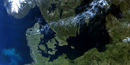
Only a few weeks after it was launched, the Copernicus Sentinel-3B satellite has delivered its first images of Earth. Sentinel-3B is the seventh Sentinel satellite launched for Copernicus. Each mission carries different state-of-the-art technology to deliver a stream of complementary imagery and data to monitor the environment.
The satellite captured the images that show the transition between day and night over the Weddell Sea in Antarctica. It also captured swirls of sea ice off Greenland on the same day. Another in this first set of images offers a rare cloud-free view of northern Europe.
It shows how the satellite is set to play it’s role in providing a stream of high – quality environmental data to improve lives, boost the economy and protect our world.
Continue reading Copernicus Sentinel-3B Delivers First Images
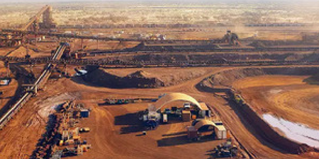
Recently, NMDC inaugurated the “Remote Sensing & GIS Lab” at Hyderabad on 02 May 2018. NMDC and NRSC (ISRO), Department of Space, Government of India joined hands through a MoU to Promote Space Applications in exploration and other mining activities for “Satellite Based Geological Mapping and Multidisciplinary Exploration of Iron, Diamond and other mineral deposits”. It is a major step forward towards “Digital India” as Space Technology provides real – time data for generation of digital maps.
The Remote Sensing and GIS Lab has two Licences, “ERDAS” and “ARC-GIS” software along with high end “Workstations”. NMDC will utilize the facility for exploration and would fully go “DIGITAL” in the areas of exploration.
Continue reading Remote Sensing and GIS Lab in Hyderabad inaugurated by Mining Major, NMDC

Hasuri Ausanpur village in Siddharthnagar district of Uttar Pradesh is a tech geek’s dream come true. Yes, you heard right. This village, with 23 Wi-Fi hotspots and 23 CCTV cameras for its population of just over 1,000, can give most high-tech college campuses a run for their money.
Continue reading Meet the sarpanch who upgraded this UP hamlet to a smart village, all for Rs15 lakh


