null

Thought Leadership


Month: January 2017

GIS Applications in Agriculture and Natural Resource Management

GIS has found use in many areas and has proven to be an asset to numerous industries. From agriculture to natural resource management and even urban planning GIS can be used in all such fields and many more to make better decisions and gain comprehensive geographic information about an area.

Though GIS applications may be many but when it comes to use of GIS in agriculture there is an essential role that these systems plays. Similarly even in natural geo resource management GIS can prove to be very useful. Some of the most important benefits of such systems in these field include-

GIS in Agriculture-

  • With GIS systems people are able to map and project current and future fluctuations in precipitation, temperature, crop output and much more.


  • These systems assist farmers in creating more efficient farming techniques which will yield better crops


  • These systems also help in soil analysis to find out which places are suitable for a particular crop


  • From area mapping to finding resources nearby there is a lot that these systems can do for agriculture needs

GIS in Natural Resource Management-


  • From land covers maps to vegetation maps, soil maps and geology maps all these can be developed using these systems


  • From gathering information regarding all present natural resources in a particular area to analysis and management all this can be done using this system


  • Using these systems can help manage, preserve and restore natural resources so that they can be used by the present as well as future generations


There is a lot that GIS is capable of in both these fields and is a system that proves very beneficial for decision making and geography management.

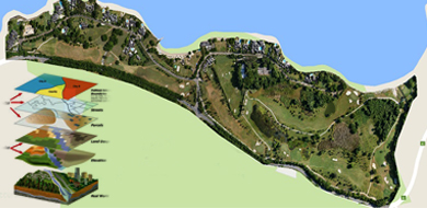
GIS Trends that Can Come Up in 2018

Geographic information Systems came as a boon for many industries allowing them to collect, manage and analyze data in a more efficient and quick manner. GIS is not a single system instead it refers to a number of technologies, processes and data collection methods. From engineers to transport and logistics, planning, management and businesses all can use GIS systems for various needs.

Like anything related to the world of information technology, GIS too is a system that is evolving and upgrading on a regular basis. For industries using this service it is important to know what new is coming up and how can they benefit from it. To help in this here are a few major trends or updates to look forward to this year-

Geographic Information System

Trends Updates Of Geographic Information System

  • User interface may improve especially when it comes to accessibility on smart phones. It is predicted that more efficient and task driven may soon come up


  • Cloud computing may be the biggest update and addition in the GIS spectrum. There are many great options that cloud can provide including security and storage capabilities.


  • The GIS industry trends for open source software, open data and standards is bound to continue this year


  • Drones regulations have come up in many places who know what changes we see this year, while there may be some ease given for GIS needs


  • Looking ahead there is a lot more that can come up in this world of GIS and before any business starts make use of this technology there are a number of things it needs to consider and be ready for.


Scroll Up