null

Thought Leadership


Category: GIS Services

GIS Applications in Agriculture and Natural Resource Management

GIS has found use in many areas and has proven to be an asset to numerous industries. From agriculture to natural resource management and even urban planning GIS can be used in all such fields and many more to make better decisions and gain comprehensive geographic information about an area.

Though GIS applications may be many but when it comes to use of GIS in agriculture there is an essential role that these systems plays. Similarly even in natural geo resource management GIS can prove to be very useful. Some of the most important benefits of such systems in these field include-

GIS in Agriculture-

  • With GIS systems people are able to map and project current and future fluctuations in precipitation, temperature, crop output and much more.


  • These systems assist farmers in creating more efficient farming techniques which will yield better crops


  • These systems also help in soil analysis to find out which places are suitable for a particular crop


  • From area mapping to finding resources nearby there is a lot that these systems can do for agriculture needs

GIS in Natural Resource Management-


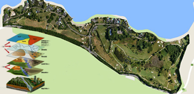
  • From land covers maps to vegetation maps, soil maps and geology maps all these can be developed using these systems


  • From gathering information regarding all present natural resources in a particular area to analysis and management all this can be done using this system


  • Using these systems can help manage, preserve and restore natural resources so that they can be used by the present as well as future generations


There is a lot that GIS is capable of in both these fields and is a system that proves very beneficial for decision making and geography management.
GIS Trends that Can Come Up in 2018

Geographic information Systems came as a boon for many industries allowing them to collect, manage and analyze data in a more efficient and quick manner. GIS is not a single system instead it refers to a number of technologies, processes and data collection methods. From engineers to transport and logistics, planning, management and businesses all can use GIS systems for various needs.

Like anything related to the world of information technology, GIS too is a system that is evolving and upgrading on a regular basis. For industries using this service it is important to know what new is coming up and how can they benefit from it. To help in this here are a few major trends or updates to look forward to this year-

Geographic Information System

Trends Updates Of Geographic Information System

  • User interface may improve especially when it comes to accessibility on smart phones. It is predicted that more efficient and task driven may soon come up


  • Cloud computing may be the biggest update and addition in the GIS spectrum. There are many great options that cloud can provide including security and storage capabilities.


  • The GIS industry trends for open source software, open data and standards is bound to continue this year


  • Drones regulations have come up in many places who know what changes we see this year, while there may be some ease given for GIS needs


  • Looking ahead there is a lot more that can come up in this world of GIS and before any business starts make use of this technology there are a number of things it needs to consider and be ready for.


4 Important GIS Applications and Uses

A GIS is a computer system that is specially designed to carry, reserve, manage, interpret, distribute, and display a variety of spatial and geographical data. These days, these GIS applications have become a necessity in various types of organization.

Check out some important GIS application and its uses:

GIS in Mapping

Mapping is a central function of Geographic Information System, it makes easy for a person to interpret the data into visual interpretation.

There are different people of varies professions that use the map to communicate. The best example of GIS mapping solutions is Google map, Bing map, Yahoo map.

Telecom and Network services

GIS application can be a great planning and decision making tool for telecom industries. It helps wireless telecommunication companies to incorporate geographic data into their network design so that they can easily plan, optimize, maintain, and check other activities.

Accident Analysis and Hot Spot Analysis

GIS has a great role to play even in minimizing accident hazard on roads. Yes, the current road network helps in optimizing which measures the road safety and check on where it needs to be improved. This all can only be achieved if you have proper traffic systems, thus, this GIS helps in rerouting the design.

Urban Planning

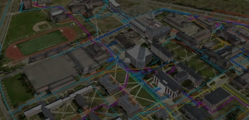
GIS application also helps in analysing the urban population and also checks from where the growth is expanding. Therefore, it finds suitable sites for further urban development. In identifying it checks on several factors such as land accessibility, land’s depth, and land should have a good supply of water.

Top 3 Benefits That GIS Offers In This Day And Age

Today, there are many industries that can reap the benefits offered by Geographic Information System (GIS). From agricultural and irrigation, to telecom, mining and oil and gas, utilizing geospatial information has become easier for all these industries and many more – thanks to the newest advancements in the world of GIS.
Let’s take a look at some of the benefits that GIS has to offer in this day and age.

Greater Efficiency

With the objectives to improve workflow or re-engineer processes, GIS ultimately helps the users to achieve greater efficiency. Whether through mapping, scanning or geo-referencing, automating processes and improving workflow has become a reality at present. As a matter of fact, with increased efficiency, wastage gets reduced to a significant level, which ultimately leads to cost-effectiveness in businesses.

Improved Decision Making

Accurate decision making, though important in all the industries, is a critical success factor in industries like real estate, urban development and planning, transportation, etc. Thus, it becomes important to rely on technologies like GIS to make the correct decisions, without any errors, while exploiting the very many opportunities that they bring for the businesses in these industries.

Real-Time Tracking

Visual communication is one of the most important forms of communication at present. Besides giving access to hard to get information and analysing the same easily, GIS enables real time tracking leading to better results in quick time.

So, take the best possible advantage of geographic information system (GIS) and visualize, analyze, and interpret data like never before!

Scroll Up