null

Thought Leadership


Tag: geospatial data conversion

A Brief Description About GIS Services

The objective of GIS is to identify new trends from the analyzed research. It is a system used to gather data and incorporate it in order to store, scrutinize, distribute and show geographic information.

Studying data using the Geographic Information System will help one learn and understand information much quicker and easier.

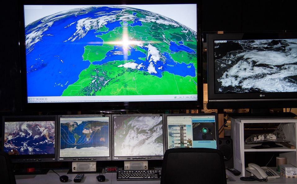
GIS data displays actual world features such as elevations, terrain and transportation networks in a digital format. It is often used to study global problems in an effort to find solutions much more quickly.

Different GIS Applications –

• An important use of GIS is for studying the climate change. It can be used in the tracking and analyzing of data regarding the impact of climate change.One can map tectonic shifts in high risk earthquake areas, using GIS mapping for public safety.
• In regards to business marketing techniques, a business can use GIS to analyze demographic data to find regions where they will likely sell their products or services.
• Governments can utilize GIS to analyze census information such as health and education statistics. This is helpful for creating or modifying public policies and government spending.
• GIS technology also provides assistance for mapping and charting in Aeronautic and Maritime fields.
• It can be used for security and law enforcement logistics, urban planning and development and evaluating a potential business market.
• Also, in the management of natural resources by National Geo Resource Management, tracking and analyzing natural disasters with the intent of improving emergency response time.There is use of GIS in agriculture as well.

What Are The Uses of GIS Maps?

GIS technology is widely used by government authorities, large organizations, business companies etc. as it gives detailed information about any location.

It basically captures, analyzes the information and stores the data based on the geographical locations. The resultant presentation is a digital map.

With the advent of computer, GIS mapping technology was invented in 1960. GIS mapping can combine all available data about a given area and deliver it in new and dynamic ways.

There has been a significant growth in the use of GIS maps due to the development of open source applications and it has also become economical for anyone to run GIS.

Geographic Information System

Benefits of GIS Maps :-

• Due to the rapid evolution of consumer electronics enabled with GPS systems, GIS mapping helps tourists to locate their exact location on the geographical map. It can also help them find the nearest gas station.

• Geographic Information System is an essential tool for anyone who wants to create geographical maps with the help of internet. A popular example of such application is Google Maps which is available worldwide.

• The power offered by these tools is perhaps most useful in the world of science. The fields of science gather data about our world in very different ways, but GIS offers unique opportunities to combine all this in one.

• GIS has great importance in the field of education as well.A teacher can use GIS to display digital maps on a projector during their teaching session, so that students can easily understand the syllabus and study in detail about the geographical locations.

Advantages of GIS Services across Different Sectors

GIS Services is a technology specifically designed to capture, analyze, manage and present all types of spatial and geographical data.These services have aided national security and law enforcement as well. Several companies are reaping big benefits due to these GIS services. They rely on the data rooted in computer mapping and satellite imageries to leverage work efficiency, take strategic decisions and select a better consumer group and increase the efficiency of the business.

These services basically aids essential business functions such as marketing, logistics and strategic decision making. The company offering such services provides valuable support in defining business requirements.Also, industry policies and standards, database design and implementation, application development.

Services Providing Area

For Business

The GIS services uses technology to trace location.This is very useful in marketing and sales, logistics and transportation, human resource and other fields. It is well integrated with targeted marketing and market analysis, routing and logistics.

For Education

GIS is now a very important tool that helps the education department to send across the answers from local to global implications.

Natural Resources

This technology helps biologists, ecologists, environmental regulators, astronomers, and miners etc to make difficult decisions regarding the handling of the earth’s natural resources.

Government

Due to the improved decision making processes, as a result of GIS, service delivery and citizen management have become easier. As most of the data in the government is location-based.Thus, smoother operations can be expected.

Maritime

GIS technology also provides good assistance in mapping and charting in Aeronautic and Maritime fields. It immediately starts producing geospatial data and provides high quality products with tools in making and maintaining the results.It also tracks the status and progress of jobs through the complete cycle.

Scroll Up