null

Thought Leadership


Category: General

Significance of GIS Document Management Systems

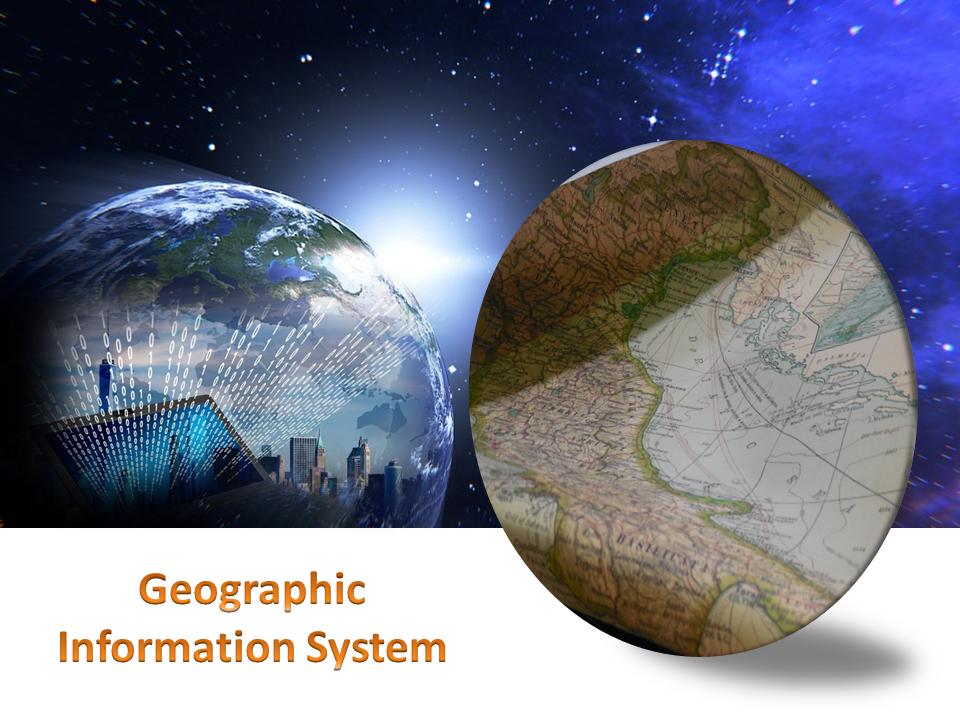
Today, in the digital world, hard copies need to be converted to digital form before being used for any service. This is because digital maps are easy to maintain. They take up less space and can be preserved for a longer time. Therefore, GIS Document Management System plays a vital role.

Many small and medium business think that the digital solution for document management is for large corporations but small businesses too have begun to implement software document management in their business operation. Since the cost is relatively lesser.

Adopting a system of documentation through GIS-based survey and mapping with spatial details will end false transactions. The UPOR launched as a pilot project in Mysuru in 2010 is expected to be a solution to end fraudulent land transactions.

The digital document management will help maximize the processes related to recovery. Also, management of large files. This means you can search for documents based on certain words or phrases and get the desired results in seconds, while the record of this type might have taken hours before.

Thus, instant retrieval of documents is possible because as you scan and convert, you can apply OCR and documents can be searched based on text content.

For such services, you may get in touch with us. We are a well – known GIS document management company providing services including management, alignment, scanning large maps and indexing of digital data. We also take care of each aspect to preserve the originality of the document.

What is the Importance of GIS Data Conversion?


Esri, the global leader in spatial analytics informed about the release of Intelligence Configuration for ArcGIS Pro (ICAP). This will bring the most commonly used ArcGIS data management tools to the forefront in order to better support intelligence analysts.

Document, E-book and pdf conversion among others are the different kinds of data conversion.

GIS Data Conversion

• It is a critical process in the migration of information from existing information databases to new ones that often require changes in data formats.
• It refers to the alteration and transfer of data between different systems, when the systems undergo replacement or updates.
• It is also of great importance in the insurance sector. Companies can make use of different strategies for converting data to ensure that the data is compatible with their systems.

Right data conversion should ensure the following:-

• Data is converted into an appropriate format and is transferred correctly
• Data works in the new destination database
• Data retains it’s quality and data consistency is maintained at all times across all the systems.

GIS Consortium has the capability to convert hard copy into a wide range of electronic formats. GISC’s team of experienced and multi – skilled specialists have a vast knowledge of converting various types of geospatial data. It can deal with the present day challenges such as complexity of data, project timelines and effect on the quality and accessibility of the data, ensuring a smooth and successful data conversion.

For a good quality GIS Services, you can get in touch with the GIS Consortium.

A Brief Description About GIS Services

The objective of GIS is to identify new trends from the analyzed research. It is a system used to gather data and incorporate it in order to store, scrutinize, distribute and show geographic information.

Studying data using the Geographic Information System will help one learn and understand information much quicker and easier.

GIS data displays actual world features such as elevations, terrain and transportation networks in a digital format. It is often used to study global problems in an effort to find solutions much more quickly.

Different GIS Applications –

• An important use of GIS is for studying the climate change. It can be used in the tracking and analyzing of data regarding the impact of climate change.One can map tectonic shifts in high risk earthquake areas, using GIS mapping for public safety.
• In regards to business marketing techniques, a business can use GIS to analyze demographic data to find regions where they will likely sell their products or services.
• Governments can utilize GIS to analyze census information such as health and education statistics. This is helpful for creating or modifying public policies and government spending.
• GIS technology also provides assistance for mapping and charting in Aeronautic and Maritime fields.
• It can be used for security and law enforcement logistics, urban planning and development and evaluating a potential business market.
• Also, in the management of natural resources by National Geo Resource Management, tracking and analyzing natural disasters with the intent of improving emergency response time.There is use of GIS in agriculture as well.

What Are The Uses of GIS Maps?

GIS technology is widely used by government authorities, large organizations, business companies etc. as it gives detailed information about any location.

It basically captures, analyzes the information and stores the data based on the geographical locations. The resultant presentation is a digital map.

With the advent of computer, GIS mapping technology was invented in 1960. GIS mapping can combine all available data about a given area and deliver it in new and dynamic ways.

There has been a significant growth in the use of GIS maps due to the development of open source applications and it has also become economical for anyone to run GIS.

Geographic Information System

Benefits of GIS Maps :-

• Due to the rapid evolution of consumer electronics enabled with GPS systems, GIS mapping helps tourists to locate their exact location on the geographical map. It can also help them find the nearest gas station.

• Geographic Information System is an essential tool for anyone who wants to create geographical maps with the help of internet. A popular example of such application is Google Maps which is available worldwide.

• The power offered by these tools is perhaps most useful in the world of science. The fields of science gather data about our world in very different ways, but GIS offers unique opportunities to combine all this in one.

• GIS has great importance in the field of education as well.A teacher can use GIS to display digital maps on a projector during their teaching session, so that students can easily understand the syllabus and study in detail about the geographical locations.

Applications of GeoReferencing

GeoReferencing is the method of assigning the real-world coordinates to each pixel of the raster. Usually, these coordinates are obtained by doing proper field surveys and collecting coordinates with a GPS device for few easily identifiable features in the image or the map.

It is basically a means to associate something with locations in the physical space or the process of associating a physical map or raster image of a map with spatial locations.

The importance of Georeferencing lies in its ability to turn non-spatial imagery into spatial raster data for use in a variety of circumstances. Spatialized air photos can be used for GIS land cover analysis.

Following Are Some of the Uses of Georeferencing:-

• It makes the different imagery required for mapping. It explains how other data, such as the above GPS points, relate to the imagery.

• Necessary information may be contained in data or images produced at a different point in time. It can be used to compare this data with that currently available.

• Different maps may use different projection systems. The tools of Georeferencing contain methods to combine and overlay these maps with minimum distortion.

• Data obtained from surveying may be given a point of reference from topographic maps by the application of GeoReferencing.

• It may be required to establish the significant relationship between social survey results which have been coded with postal codes or street addresses.

Also, for other geographic areas such as census zones or areas such as public administration or service planning.

Advantages of GIS Services across Different Sectors

GIS Services is a technology specifically designed to capture, analyze, manage and present all types of spatial and geographical data.These services have aided national security and law enforcement as well. Several companies are reaping big benefits due to these GIS services. They rely on the data rooted in computer mapping and satellite imageries to leverage work efficiency, take strategic decisions and select a better consumer group and increase the efficiency of the business.

These services basically aids essential business functions such as marketing, logistics and strategic decision making. The company offering such services provides valuable support in defining business requirements.Also, industry policies and standards, database design and implementation, application development.

Services Providing Area

For Business

The GIS services uses technology to trace location.This is very useful in marketing and sales, logistics and transportation, human resource and other fields. It is well integrated with targeted marketing and market analysis, routing and logistics.

For Education

GIS is now a very important tool that helps the education department to send across the answers from local to global implications.

Natural Resources

This technology helps biologists, ecologists, environmental regulators, astronomers, and miners etc to make difficult decisions regarding the handling of the earth’s natural resources.

Government

Due to the improved decision making processes, as a result of GIS, service delivery and citizen management have become easier. As most of the data in the government is location-based.Thus, smoother operations can be expected.

Maritime

GIS technology also provides good assistance in mapping and charting in Aeronautic and Maritime fields. It immediately starts producing geospatial data and provides high quality products with tools in making and maintaining the results.It also tracks the status and progress of jobs through the complete cycle.

How To Process LiDAR Data – 3D Survey

The use of lidar data processing has erupted in recent years, for many good reasons. The Lidar technology helped in producing higher-quality results than traditional photogrammetric techniques that cost low. Therefore, this has created a huge accomplishment to a large extent by the automatically collecting measurements very densely. The progress in laser scanning hardware has been astonishing.

One of the major side effects of switching to lidar-based technology is that it has many challenges in increasing the data volume and the development of software processing abilities required. Fortunately, there are many benefits offered by Lidar technology such as LiDAR Mapping Services, lidar data processing workflow, and Lidar 3D Scans.

Here are Some Tips that enable you to take Advantage of Lidar Data Processing.

1. Have Lidar in LAS Format

Having a lidar in LAS format can be visible to the admitted but not to the one who is new to using lidar data. LAS stand for Laser is the industry standard format for lidar. This helps in choosing the best format that works best.

2. Make Sure the LAS Files Are “Tempered” for Use in GIS

When you have to use LAS, a lot of things go on between initial data collection of LAS files a ready to use the file. Therefore, you can use LAS as there are many flavors out of which some are better than others for use in GIS.

3. Consider Your Options

Look for a company that provides several complimentary options for accessing lidar. Basically, there are three primary data access tools: the LAS dataset, the region dataset, and the mosaic dataset. Therefore, if you will learn about them you will get a better idea to determine which one is for use.

4. Stage Data Appropriately

Lidar data is quite large and requires careful planning to avoid producing a network to its knees or making users wait for long to display.

Therefore, if you have to determine the best overall approach, make sure you get your questions and queries solved. Questions such as – How large is the dataset? And will the whole lidar samples process in order to ad-hoc queries?

GIS Trends that Can Come Up in 2018

Geographic information Systems came as a boon for many industries allowing them to collect, manage and analyze data in a more efficient and quick manner. GIS is not a single system instead it refers to a number of technologies, processes and data collection methods. From engineers to transport and logistics, planning, management and businesses all can use GIS systems for various needs.

Like anything related to the world of information technology, GIS too is a system that is evolving and upgrading on a regular basis. For industries using this service it is important to know what new is coming up and how can they benefit from it. To help in this here are a few major trends or updates to look forward to this year-

Geographic Information System

Trends Updates Of Geographic Information System

  • User interface may improve especially when it comes to accessibility on smart phones. It is predicted that more efficient and task driven may soon come up


  • Cloud computing may be the biggest update and addition in the GIS spectrum. There are many great options that cloud can provide including security and storage capabilities.


  • The GIS industry trends for open source software, open data and standards is bound to continue this year


  • Drones regulations have come up in many places who know what changes we see this year, while there may be some ease given for GIS needs


  • Looking ahead there is a lot more that can come up in this world of GIS and before any business starts make use of this technology there are a number of things it needs to consider and be ready for.


Top 3 Benefits That GIS Offers In This Day And Age

Today, there are many industries that can reap the benefits offered by Geographic Information System (GIS). From agricultural and irrigation, to telecom, mining and oil and gas, utilizing geospatial information has become easier for all these industries and many more – thanks to the newest advancements in the world of GIS.
Let’s take a look at some of the benefits that GIS has to offer in this day and age.

Greater Efficiency

With the objectives to improve workflow or re-engineer processes, GIS ultimately helps the users to achieve greater efficiency. Whether through mapping, scanning or geo-referencing, automating processes and improving workflow has become a reality at present. As a matter of fact, with increased efficiency, wastage gets reduced to a significant level, which ultimately leads to cost-effectiveness in businesses.

Improved Decision Making

Accurate decision making, though important in all the industries, is a critical success factor in industries like real estate, urban development and planning, transportation, etc. Thus, it becomes important to rely on technologies like GIS to make the correct decisions, without any errors, while exploiting the very many opportunities that they bring for the businesses in these industries.

Real-Time Tracking

Visual communication is one of the most important forms of communication at present. Besides giving access to hard to get information and analysing the same easily, GIS enables real time tracking leading to better results in quick time.

So, take the best possible advantage of geographic information system (GIS) and visualize, analyze, and interpret data like never before!

Scroll Up